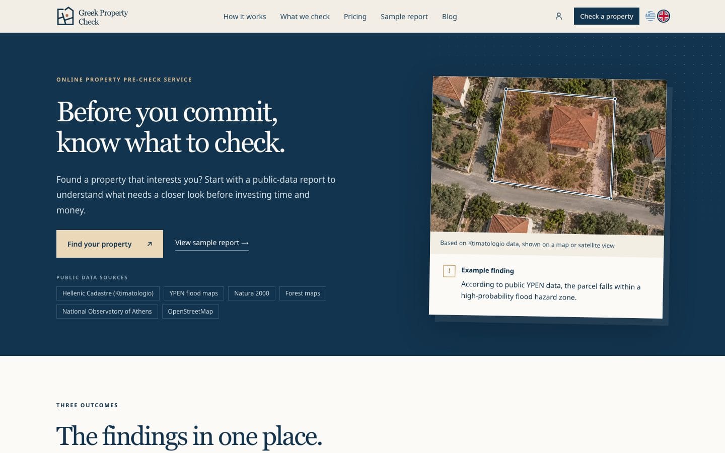
A few weeks ago we launched a new product: Greek Property Check.
It is our own product, not a client project. We designed it, built it and we run it. This is the story behind it.
Why we built it
Two things came together.
First, we could not find anything like it established on the Greek market. If you found a property and wanted to know what the public maps say about the plot, you had to dig through several government sites, mostly in Greek.
Second, more and more useful data has been showing up on data.gov.gr: cadastral parcels, flood maps, forest maps, protected areas and more. The data was becoming available. Nobody had put it in one place for a buyer.
How it works
You find the property on the map, by address, by KAEK (the cadastral code) or with a click, and select its parcel. This step is free, so you can confirm you have the right plot before paying for anything.
Then you can get a paid report, in English and Greek, of what public data shows for that parcel and what you should still ask your lawyer or engineer.
- Core (€19 + VAT): the Hellenic Cadastre, Ministry of Environment flood maps, Natura 2000 and forest maps.
- Extended (€39 + VAT): everything in Core, plus land cover, climate, historic floods and active-fault context.
Both come with a PDF and a 90-day share link, so you can pass the report to your lawyer or engineer. What would take hours of searching across different sites and maps, you get in a few minutes, in one place.
What it does not do
This matters as much as what it does. Greek Property Check is a first look, not a verdict. Every finding is tied to its public source, with a note on what it does not prove. An empty result is never presented as a clean bill of health.
The report does not cover title and ownership, building permits, buildability, market value, fire history or short-term rental eligibility. Those still need a lawyer, an engineer or an accountant, and the report is there to help you ask them the right questions.
The challenges
It was not as simple as it sounds.
- Scale. We process millions of cadastral parcels and map polygons, so that each check takes seconds.
- Coordinate systems. Greek map data uses the Greek Grid (ΕΓΣΑ87), so it had to be converted for every layer to line up on the same map.
- Finding the right parcel. An address or a KAEK has to be matched to the correct parcel.
- Plain language. Technical map data had to become clear findings in both Greek and English.
What is next
We plan to keep extending it with more data and findings as new sources become available.
If you are buying property in Greece, or you work with buyers as a lawyer, engineer or agent, we hope you find it useful. And if you know someone who might, feel free to pass it on.